GPS outdoor navigation app

GPS outdoor Navigation App

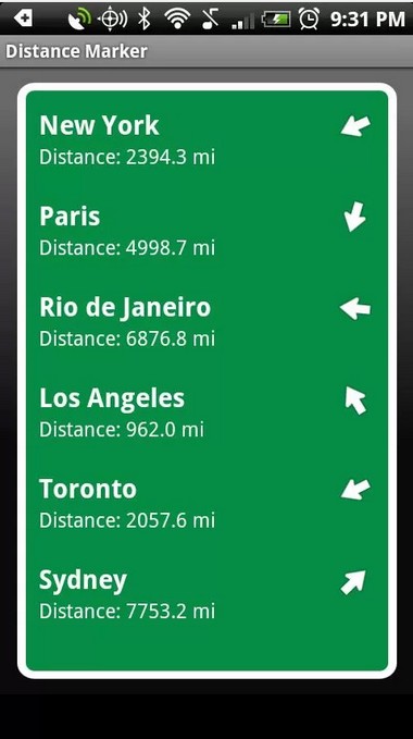
GPS outdoor navigation app helps you for hiking, geocaching, sport activities and your everyday life, whereever you want to go just keep this application with you and check the directions and distance of your location how far you are from your destination right now and a lot of other things,

This application is not required any specific internet services but It offers you the offline maps you can download those packages after installation and when you will use you won’t need for any internet or data packaging service.

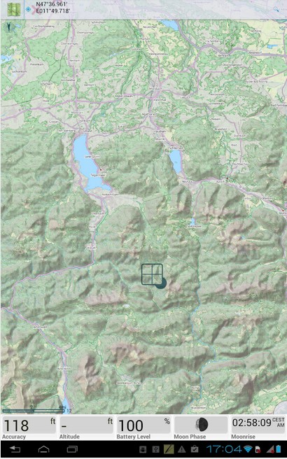
 you can download many types of cycling and hiking maps for off-line usage. It is the most Powerful system for geocaching, intelligent GPS for long battery life and many more

Mainly feature o fOnline maps It supports full WMS maps
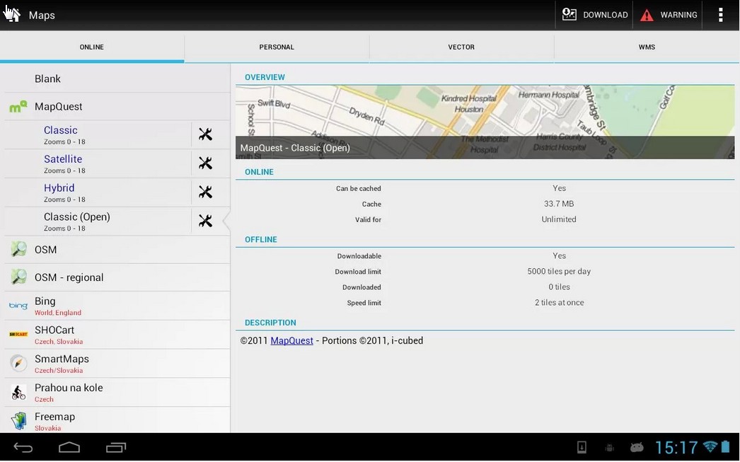
– OSM, Freemap, SHOCart, SmartMaps, MapQuest, Navigasi, Turaterkep, NzTopoMaps, Osmapa.pl, ChartBundle and more
– most of them are downloadable for offline usage without cell coverage
– you can create your offline Vector maps (for a low fee) for city, car, hiking, cycle, ski – downloadable by in-app billing
 this application support for formats SQLite, TAR maps, MBT maps, GEMF, RMAP, Orux, SmartMaps
– by using this application create own maps from Open Street Map data or custom themes
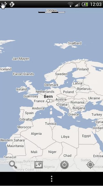
– it allows you to search by address, coordinates, own points, localized photos
– also for places around by Google Places, Wikipedia
– it handle unlimited number of points/tracks, categorize, sort, edit, import, export and much more
 – now you can use Geocaching Live! with the support for waypoints, PocketQuery, trackables, spoilers
– there are unlimited possibilities for configuration
– you have the authority to custom styles for map, like color by altitude, by speed
– It fully support for Online voice navigation
– work very good with KML, KMZ, GPX, OpenAir, DXF formats
– with its special methods to handle GPS. Satellite screen with current situation, notification on GPS state, Bluetooth GPS, advanced system for disabling GPS when is needed to conserve battery

Homepage:
– http://www.locusmap.eu
Technical support:
– http://getsatisfaction.com/locus
Knowledge base:
– http://docs.locusmap.eu
E-mail:
– support.locus@asamm.com

Community GPS Navigation App

Community GPS Navigation

especially for daily drivers.

Please Join the community of millions of drivers who are using this award-winning Scout, as it helps in your personalized mapping and GPS navigation travel application for Android. Whether it’s your daily commute, a simple direction, discovery of local events, or map of a nearby store, you’ll travel like a boss with Scout. Current maps and traffic features get you what you need with instant speed, from voice-guided directions and traffic to nearby restaurants, cheap gas, and more!

 Dashboard – Just Think of this home screen as your go-to, it is a daily toolbar to view a map of your current location,

 My Traffic – New! Now Street-Level Traffic shows you traffic flows on major roads and side streets and is also used to calculate the most traffic-optimized.

OnMyWay – A registered version which Share your ETA to let others know when you’ll arrive at your destination and let them follow your real-time progress.

Web Sync – Discover things to do and plan online at www.scout.me. Log in to sync your favorites between the site and the Scout application.

Voice Commands – you can Speak, do not need to type everything, to view a map or directions to a street address or saved place and navigate their hands free while keeping your eyes on the road to avoid accidents.

Fresh Mapping Scout maps are always updated and provide you with both 2-D and 3-D view options during navigation.

Turn-by-Turn Directions by using Voice – Pick your route and get turn-by-turn directions with award-winning Telenav.

Another feature of Car Connect Stop fumbling between your phone, radio, and headset, and instead use Bluetooth® to connect to Scout in your car with Ford SYNC® AppLink™. View turn-by-turn directions on your car’s infotainment system and hear the voice guidance over the car speakers (in-app purchase required for Car Connect).

Map Quest

Mapquest Navigation Android

The most impressive and a complete guided and popular navigation system designed for android devices is Map quest. you can never think out of picture until you use this applicaiton it is a complete package of all kind of best navigation system for transportation.

With this Excellent nav system you do not need to check and see to your phone or android device again and again Your phone speaks to you and it will tell you when you have to make a turn where you are, on which junction you need to move forward and it is a fun to use this voice Guided turn by turn navigation system.
It has the Great Traffic optimized routing which continually check the traffic along the route of your destination and it will inform you for each thing via using GPS and will adjust accordingly.

Are you Traveling and want to share your current location, your favorite business or your destination by using your email, text message Twitter or facebook, just do it, it will help you to share anything you want on these with your friends and loved ones…

While traveling do you want to change your route ? ? no need to use your hands or check the phone or device just speak your destination or your search and feel a hands free input it will change the route accordingly and provide you the accurate search results.

Are you hungry? going to some date, Out of fuel??? need some gas station? search them with one more click on your route.

While driving when your route is set but to took a wrong turn, do not need to worry, it will adjust and re route accordingly.

Are you Walking & Driving Directions – Choose to walk or drive and we’ll give you the best route either way. Helps you to get  Live Traffic Flow/Incidents – coverage updated every 5 minutes to help keep you on time.

Just switch to this amazing application and feel the difference

NAVFREE is another Navigation app for Android

Navfree Navigation App

NAVFREE, the one of the WORLD’S FIRST FREE CROWD POWERED NAVIGATION SYSTEM for android devices!

a part from other “free” satnavs Comapny is offering you a fully featured, non-timelimited turn by turn navigation. with No hidden charges: after any map or any other download you can use it forever for free and update it from time to time, absolutely for free…

We welcome you to this wonderful Android application,  Navfree is a completely free navigation app that offers turn by turn directions, spoken and on the screen instructions, very helpful for drivers your hiking plans, most importantly its offline map use and address search and live search via Google and Microsoft Bing, among many other popular search engines you can customize it with your own will.

All the maps are available for free download from the Navfree Store. you do not need to pay for anything, it is the one of most popular Application for transportation.

it stores all of its data on your device so there is no need for a constant data connection while you are driving. It also allows you to browse maps anytime, anywhere you want without paying for data connections, you do not need to pay roaming charges if you are in abroad.

It uses high quality, and open source map data from OpenStreetMap that has been created and is continually improved by as many as 400,000 users around the world.
THIS APPLICATION HAS A LOT OF FEATURES FOR YOU AND WE ARE SURE YOU WILL LIKE THESE

– it helps you to Browse maps by dragging and scrolling.
– provides you On-board maps – no data connection required to browse maps or navigate (offline address search in UK & ROI only).
– always offers Multiple guidance displays – and a toggle between 2D, 3D and safety screen mode.
– user friendly touch interface
– Day and night maps saparately
– another special feature Music volume automatically fades out when voice guidance is played.
– it zooms automatically at junctions.
– Fast routing engine allows you to calculate long routes in seconds.
– if you miss a turn, Navfree reroutes you automatically.
– It provides you a demo route plan before you leave.
– Its special Direction lists allow you to check each step of your journey.
– It has a dedicated pedestrian navigation.
   Search by the exact address or postcode of your destination.

Available maps are : Andorra, Argentina, Australia, Austria, Benelux (Belgium, Netherlands, Luxembourg), Brazil, Canada, Croatia, Czech Republic, Denmark, Finland, France, Germany, India, Ireland, Italy, Latvia, Mexico, Monaco, Netherlands, New Zealand, Norway, Poland, Portugal, Slovenia, South Africa, Spain, Sweden, Switzerland, UK.

CoPilot navigation application

CoPilot navigation application

CoPilot navigation application proves its words and now you don’t need to spend a lot to get a good sat nav. Because it is the one of best and popular navigation application specially designed for drivers.

CoPilot Live Premium is the essential with voice guided GPS navigation app for Android.  you do not need to type it all While you are driving just say the location name and it will navigate you towards it.

It’s compatible with more than 280 droids including the amazing Samsung Galaxy S4, Note 1 & 2, HTC One X and Google Nexus 7! now  it is optimised also for htc one, droid dna and other droids with hd screens as well!
it provides you the Detailed street maps of one single European region (e.g. UK + Ireland ) are stored on-board your phone or tablet (select and download your map region via WiFi after installation) so you don’t need to rely on your mobile connection for navigation. Your Droid IS your CoPilot in your services always help you while you drive.

It is a real threat to stand  alone devices
there are many REASONS WHY YOU NEED A COPILOT
–  mainly Offline navigation: maps of one European country or region (e.g. UK & Ireland) are stored on your smartphone or tablet so you can navigate without Internet and mobile signal (select and download maps via WiFi after purchase)

*  YOUR DRIVER-FRIENDLY COPILOT
*  SAFETY-FIRST COPILOT
*  with its package 12 MONTHS ACTIVETRAFFICâ„¢ is INCLUDED
*  it is now specially OPTIMISED FOR ANDROID
*  it is YOUR LOCAL COPILOT
*  MAPS INCLUDED:
–  it has the Detailed street maps of one European country or region (e.g. UK & Ireland) are stored on-board your phone or tablet. Select and download your region via WiFi after installation.
*  PLUS ALL THE FEATURES YOU’D EXPECT FROM A SATNAV
it provides you Twitter and Facebook status updates and more!
Full details at www.copilotlive.com
Twitter: @copilotlive
Facebook: facebook.com/copilotlive
Google+: search +copilot live

Tube Mape for Android

Tube Map

Tube Map is the number 1 FREE cross platform tube application . With its over 5 million users; it has been re designed specifically for Android.

It is packaged application with full of cool features including; LIVE arrival and  departure information, station finder, journey planner and oyster balance check and many more . Do not  just take our word for it. Download it now and feel the differece.

– It has won London Transport Award – Excellence in Technology winner 2013.
– Also winner of The Appsters Awards – Best use of Geo-Location winner 2012.
– About this application Apps Magazine says ‘Tube Map gives you an advantage over the always-perilous London Underground for the grand price of nothing. A truly wonderful app’ 5 stars.
– It is a featured on “British Pride” in the Google Play Store.
• Most importantly Official licensed Tube map from Transport for London.
• Its Map features all stations that support Oyster PAYG services.
• It is the World’s fastest route planner giving line direction towards your destination.
• now you can Find your nearest station very easily.
• It provides you a live departure boards and station information.
• It has the Oyster Account access – now you can check your Oyster Card balance wherever you are.
• also provides you Twitter integration – access to Tube Map’s aggregated feed of Status and News Tweets within one platform.
We recommend you to join us on Facebook at www.facebook.com/mxDataLtd. our team would love to hear from you, we always welcome suggestions and comments to make this application more reliable for you.
Details of permissions used in Tube Map:
– INTERNET – This permission is used to provide access to live information, Twitter feeds and for advertising only.
– ACCESS NETWORK STATE – This permission is used to determine network connectivity status for advertising only.
– ACCESS FINE LOCATION – This permission is used to facilitate location functionality when finding nearby stations using GPS only.
– READ PHONE STATE – This permission is used to get device ID required for advertising only. It is not used to collate any other information about phone state or usage.

Download the application and be one of the satisfied users.

Distance Maker Navigation App

Distance Maker

A new android application for navigation, but in very short time it proves it self as a one of the most popular nav system for android and tablet.

It Display a road sign with the distance towards your navigated location and direction on the screen of your android device or tablet.

It is one of the Great android application for road trips, Distance Marker is really a fun app that is able to display your favorite locations on a road sign.

It Uses the GPS position for your location navigation and the compass to calculate the directions both works together and provides you an awesome output.

Distance Marker is basically an amusing application  that allows you to tell how far away given places are from your location.

– With Much like the signs you’ll find at all tourist trap style landmarks.
– It can tell you distances in mi , KM’s or even in funny ways such as ‘very far’ and while not that useful at actually giving directions.
– the application is absolutely free of cost and it is  a great little application  to have on your Android phone device and on tablet.

V 1.0.1 does not show any empty space on sign and fixes a crash.

GPS Essentials Navigation App

GPS essentials Navigation for Android

This is the most complete GPS tool in android market  it Navigate, manage waypoints, tracks, routes, and build your own customized dashboard from its amazing  fourty five special widgets.

In its Dashboard it shows many navigation values such as: Accuracy, Altitude, Speed, Battery, Bearing, Climb, Course, Date, Declination, Distance, ETA, Latitude, Longitude, Max Speed, Min Speed, Actual Speed, True Speed, Sunrise, Sunset, Moonset, Moonrise, Moon Phase, Target, Time, TTG, Turn.
 It has a good Compass which Shows the orientation of the earth’s magnetic field. Also a marine orienteering compass.

 it helps you to Record tracks and view them on map. now you can Export KML files and import into Google Maps, Google Earth and others.
A special guideline for all type of routes; you can Manage routes and view them on map. Import KML files from Google Maps, Google Earth and others. Create turn-by-turn instructions between waypoints.

it has a camera supported services by which you can view to show your way points and take pictures and share them with others any time any where.

 Map
A map to show your waypoints. Convert mail addresses of your contacts to waypoint so that they can be used within the app.
Supports Google Maps, MapQuest, OpenStreetMap and others.

 Waypoints
A list of all your waypoints with export and import (KML and GPX format).
 Satellites

A sky view of the current positions that shows satellites in view.

 Features
Supported position formats: UTM, MGRS, OSGB, Degree-Minute-Second, Degree-Minute-Fractions, Decimal, Mils. Supports over 230 datums.
Waypoints, routes and tracks can be exported as KML or GPX files and sent by email or uploaded to Google Docs or DropBox.
Please open the web page below for more info, send me emails for support. I CANNOT HELP IF YOU SIMPLY PLACE A COMMENT HERE.
Purchase the “GPS Essentials Donation Plugin” on Android Market if you want to support development.
In its  latest beta release which is available at http://www.gpsessentials.com for download. you can get the latest features and help us improve GPS Essentials!

Upgraded version do not show ads
This application GPS Essentials is not affiliated with any political party nor with any other organization mentioned in the ads, and it has no connection with any economic interests. If you don’t like the ads, we recommend you to please contact the AdMob.

Google Maps is your new best friend

Google Maps for Android

Maps by Google helps you to Explore new places, discover new local favorites, and navigate your world with Google Maps. Available on Android phones and tablets with a simple, easy to use and a user friendly design.

*  Google maps android application is the most popular application you will ever use or think about.
* It helps you to Get where you need to go quickly with your voice guided turn-by-turn GPS navigation or try to do public transit, to all of your biking and walking directions individually
*  with its help you can find the perfect spot for any kind of occasion with some local reviews from your trusted friends and experts and not only from your friends but also from others who visited that place
* make your Tour cities with stunning, 360-degree Street View and see inside restaurants, museums and much more
– what you need to do is just Sign in to save favorite locations in to your android phone device or in the tablet and   get tailored recommendations for all of those locations or directions , and access past searches across devices and it is very simple to use.

Please note Some features not available in all countries but it has the maximum number of features you ever imagine
* Another Update will be rolling out to Android 4.0.3+ users over few weeks. Users with Android versions below 4.0.3 should visit http://goo.gl/5AMJS to learn about the app features available to you.
* You can make a map area available offline by tapping the search box and selecting “Make this map area available offline” Visit http://goo.gl/wawgE to learn more.
* Google Latitude is no longer part of the Google Maps app, and we’re retiring Latitude on August 9, 2013 (http://goo.gl/DIxJM). However, we invite you to try Google’s new location features (http://goo.gl/Mdk4o), which includes seeing friends on a map with Google+ for Android.

MapDroyd offline maps for Android

MapDroyd

MapDroyd is one of the top ranked and popular android nav application which has the number 1 quality service from all applications – it offers youthe offline maps for the whole planet

By using this wonderful MapDroyd, now you can explore maps for the whole world by few clicks and search for addresses and places in one place. You can see and track your current location on a scalable vector map no need to search here and there every thing you need is here in one application (its interface) just type your required way or location and get it in front of you.

It does not only provide you the tiled maps but also Other than tiled maps you can rotate your map view in any direction and also change the perspective from a flat 2D map to a 3D perspective view because it has the awesome quality of 2d and 3d view for each map and location you want.. It allows you  to pick from different map styles without downloading new map data.

with this application you will feel Having the whole world in your pocket, this application saves your money by avoiding data costs, especially when you’re abroad and need to roam. Just use a public Wifi hot spot (e.g. at the airport or at your hotel) to pre-download the desired map regions on your device’s card and you’re set

.
MapDroyd’s main features are as follows :
– Offline (onboard) vector(!) map rendering and search
– Worldwide maps based on OpenStreetMap raw data
– Map downloads are free of charge
– Regular map updates (every 4 to 6 weeks)
– Form based address and Point Of Interest search
– Smart single line search
– Features a simple tracking mode
– Determines postal address at your current or explored position
– Includes a map download and update manager
– Customizable storage space